

Have you ever wondered how birds manage to find the shortest route from point A to point B? It’s a remarkable feat of nature that has inspired humans to create tools that mimic this efficiency. Welcome to the world of “how the crow flies” distance calculations. Ever wished you could measure distances as accurately as a crow can fly? Well, you’re in for a treat. In this article, we’ll unravel the secrets behind this fascinating concept and introduce you to the “How the Crow Flies Calculator,” a tool that can make your navigation and planning tasks a breeze.
In this article, we will delve into the mechanics of this calculation, explore its practical uses in various scenarios, and even show you how to calculate it manually. Whether you’re a traveler, a real estate agent, or simply curious about this unique way of measuring distance, read on. By the end, you’ll have a clear understanding of how the crow flies can make your life easier and more efficient. So, fasten your seatbelts, and let’s take off into the world of precise distance measurement.
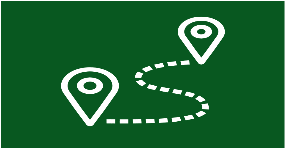
What is the “How the Crow Flies” Calculation
The “How the Crow Flies” calculation is, at its core, a straightforward and elegant concept, representing the straight-line distance between two points on the Earth’s surface. This seemingly simplistic notion, however, carries profound implications and finds its utility across a wide spectrum of scenarios, transcending the bounds of geography and seeping into diverse fields of human endeavor.
Imagine two points on a map, perhaps your current location and a distant city you’re planning to visit. The “How the Crow Flies” calculation draws a direct line between these points, disregarding any geographical obstacles, such as mountains, rivers, or roads. It’s the shortest route a crow could take to travel from point A to point B, hence the name.
But why is this calculation valuable, you might ask? Well, its value extends far beyond mere curiosity. Let’s delve into a few scenarios where the “How the Crow Flies” calculation becomes indispensable:
1. Travel Planning: For wanderlust-driven globetrotters and weekend adventurers alike, knowing the crow flies distance between destinations can be a game-changer. It helps in estimating travel time more accurately, allowing you to plan your trips efficiently. Whether you’re embarking on a road trip, booking flights, or even charting hiking routes, this calculation can provide crucial insights.
2. Real Estate: In the world of property, location is everything. Real estate agents and property developers often use crow flies calculations to determine distances between potential properties and key amenities or landmarks. This information aids in assessing property values and evaluating the convenience factor for potential buyers.
3. Infrastructure and Urban Planning: City planners and architects use crow flies calculations to design transportation systems, utilities, and urban layouts. It’s an essential tool for ensuring that essential services are easily accessible to residents, and for optimizing infrastructure development.
4. Wildlife Conservation: Biologists and conservationists employ this calculation to study animal migration patterns, the range of endangered species, and habitat planning. By understanding how the crow flies, they can better protect and preserve our natural world.
5. Telecommunications: In the digital age, the crow flies distance takes on new significance. Telecommunications companies use it to plan the placement of cell towers, ensuring optimal coverage. It also plays a crucial role in the implementation of broadband networks and other connectivity solutions.
As you can see, the “How the Crow Flies” calculation is no mere curiosity; it’s a practical tool with far-reaching implications. Its simplicity, grounded in the notion of a crow’s straight-line journey, conceals a complexity that influences our lives in myriad ways. So, whether you’re a travel enthusiast mapping out your next adventure or a city planner shaping the urban landscapes of the future, understanding the crow flies distance can be your secret weapon for precision and efficiency. In a world where every mile matters, this calculation empowers you to navigate distances with unwavering accuracy.
How Crow Flies Calculator Works
Navigating distances with precision requires an understanding of the intricate workings of the “How Crow Flies” calculator. At its core, this calculator employs a deceptively simple principle – measuring the straight-line distance between two points on the Earth’s surface. However, beneath this simplicity lies a fascinating world of mathematics and geographic coordinates, all designed to provide you with the most accurate distance calculations.
Basic Principles and Mathematics:
The magic begins with basic geometry. The Earth, though not flat, can be approximated as such over short distances, allowing us to use Euclidean geometry. Imagine the Earth as a giant sphere with points defined by latitude and longitude coordinates. The crow flies calculator takes these coordinates and leverages the Pythagorean theorem to calculate the shortest distance between them.
Here’s the mathematics in a nutshell:
- The Earth’s surface is divided into a grid of latitude and longitude lines, creating a network of points.
- When you input two sets of coordinates (latitude and longitude) into the calculator, it identifies these points on the grid.
- Then, it calculates the horizontal and vertical differences (in degrees) between the two points.
- These differences are then converted into nautical miles (1 degree of latitude = 60 nautical miles).
- Finally, the calculator uses the Pythagorean theorem to find the straight-line distance between the two points on the Earth’s curved surface.
Using Latitude and Longitude for Precision:
Latitude and longitude coordinates are the building blocks of the crow flies calculator’s precision. Latitude measures north-south positions, while longitude measures east-west positions. Together, they pinpoint any location on Earth with remarkable accuracy.
Here’s how it works:
- Latitude lines run parallel to the equator, with 0 degrees at the equator, 90 degrees at the North Pole, and -90 degrees at the South Pole.
- Longitude lines run from the North Pole to the South Pole, with 0 degrees at the Prime Meridian in Greenwich, England, and 180 degrees at the International Date Line in the Pacific Ocean.
- By inputting these coordinates into the calculator, it knows precisely which points on the Earth’s grid you’re referring to.
Example Calculation for Clarity:
Let’s put theory into practice with an example. Say you’re planning a road trip from New York City to Los Angeles. You want to know the crow flies distance between these two iconic cities.
- New York City’s coordinates: Latitude 40.7128° N, Longitude 74.0060° W.
- Los Angeles’s coordinates: Latitude 34.0522° N, Longitude 118.2437° W.
The crow flies calculator takes these coordinates and performs the following steps:
- Calculates the difference in latitude: 34.0522° – 40.7128° = -6.6606°.
- Calculates the difference in longitude: -118.2437° – (-74.0060°) = -44.2377°.
- Converts these differences into nautical miles (1 degree of latitude ≈ 60 nautical miles):
- Latitude difference in nautical miles: -6.6606° * 60 ≈ -399.636 nautical miles.
- Longitude difference in nautical miles: -44.2377° * 60 ≈ -2654.262 nautical miles.
- Applies the Pythagorean theorem to find the straight-line distance: √((-399.636)^2 + (-2654.262)^2) ≈ 2664.15 nautical miles.
So, the crow flies distance between New York City and Los Angeles is approximately 2664.15 nautical miles, which translates to about 3066.33 miles on land. This level of precision, achievable through latitude and longitude coordinates and basic geometry, empowers travelers, planners, and professionals across various fields to make informed decisions and navigate the world with unwavering accuracy.
Practical Uses

In the realm of practicality and real-world applications, the concept of crow flies distance emerges as a silent but powerful ally. It’s not just a mathematical curiosity; it’s a tool that resonates through diverse facets of our lives, from navigation to real estate, providing insights and solutions that might otherwise remain obscured.
Navigation: The most immediate and practical application of crow flies distance lies in navigation. Whether you’re plotting a course on a nautical chart or using a GPS device, understanding the straight-line distance between two points is essential. Imagine you’re a ship’s captain charting a course across the open sea. Knowing the crow flies distance allows you to estimate fuel consumption, travel time, and the most efficient route to your destination. It’s a critical factor in maritime logistics, ensuring ships reach their ports of call with precision.
Travel Planning: Beyond the high seas, travelers of all kinds benefit from crow flies calculations. If you’re planning a road trip, you might want to know the direct distance between cities, not the convoluted path dictated by highways. Air travelers, too, can appreciate the simplicity of crow flies distance when estimating flight times and fuel consumption. It’s a tool that brings transparency to travel, allowing you to make informed decisions and ensure your journeys are as smooth and efficient as possible.
Real Estate: In the world of real estate, location is paramount. Crow flies distance is a secret weapon for real estate agents and developers. Picture a potential homebuyer looking for a property with specific requirements—a school, a hospital, or a shopping district within easy reach. Crow flies distance calculations reveal the precise proximity of these amenities to the property, helping buyers make informed choices. For developers, it’s an invaluable tool for urban planning, ensuring communities are strategically situated to meet residents’ needs.
Wildlife Conservation: Beyond the confines of urban landscapes, conservationists and ecologists employ crow flies distance in the service of wildlife preservation. It aids in the study of animal migration patterns, the calculation of habitat ranges, and the planning of protected areas. By understanding the direct distances animals travel, we can better protect their environments and safeguard our planet’s biodiversity.
Telecommunications: In our hyper-connected world, the crow flies distance assumes a new role in telecommunications. It guides the placement of cell towers and the expansion of broadband networks, ensuring seamless connectivity for communities. By understanding direct distances, telecom companies optimize their networks, providing faster and more reliable services to consumers.
A Real-World Example: Consider a logistics company responsible for delivering packages across a sprawling metropolis. By utilizing crow flies distance calculations, they can optimize their delivery routes, reducing travel time and fuel consumption. This efficiency not only saves costs but also lowers the company’s carbon footprint—a win-win scenario.
In sum, the practical uses of crow flies distance are as diverse as the scenarios in which it’s applied. It’s a tool that simplifies complex decisions, streamlines processes, and empowers professionals and individuals alike. From seafarers charting a course to real estate agents closing deals, and from wildlife experts preserving ecosystems to telecom providers connecting communities, the straight-line simplicity of crow flies distance quietly shapes our world, one precise calculation at a time.
Crow Flies vs. Actual Distance
Navigational precision often hinges on a subtle yet critical distinction: the difference between crow flies distance and actual travel distance. Understanding when to employ one over the other can significantly impact decision-making across various domains. Here, we delve into the nuances of these two measurements, highlighting their key disparities, pinpointing scenarios where their applications diverge, and elucidating why this distinction is paramount.
Key Differences:
Directness vs. Practicality: Crow flies distance represents the shortest path between two points on the Earth’s surface, akin to a bird’s flight. In contrast, actual travel distance considers the practical route humans or vehicles must follow, which often involves navigating roads, highways, and terrain. The primary difference lies in the directness of the measurement; crow flies distance is a straight-line calculation, while actual travel distance considers real-world obstacles.
Curvature of the Earth: The Earth is not flat, and this curvature becomes evident when examining long distances. Crow flies distance, being a straight-line measurement, does not account for the Earth’s spherical shape. Actual travel distance, on the other hand, accommodates the Earth’s curvature, resulting in measurements that are generally longer than their crow flies counterparts.
Accuracy vs. Pragmatism: Crow flies distance is valued for its accuracy in measuring the “as-the-crow-flies” distance between two points. However, this level of precision may not always be practical. Actual travel distance provides a more pragmatic representation, accounting for the complexities of traversing real-world routes.
When to Use Each Measurement:
Crow Flies Distance:
- Use crow flies distance when precision is paramount. For example, in aviation, knowing the direct distance between two airports is crucial for flight planning and fuel calculations.
- Employ crow flies distance in scenarios where obstacles like rivers, mountains, or impassable terrain are not a concern, such as when calculating the distance between two points within a city with excellent road infrastructure.
Actual Travel Distance:
- Utilize actual travel distance for practical planning, such as road trips, commutes, and logistics. This measurement accounts for the winding roads, highways, and detours you’ll encounter in the real world.
- When considering commuting or shipping goods, the actual travel distance provides a more accurate representation of the time and resources required to reach a destination.
Scenarios of Significantly Differing Measurements:
Mountainous Terrain: In mountainous regions, the crow flies distance between two locations may be relatively short, but the actual travel distance could be significantly longer due to winding roads that navigate steep inclines and descents.
Island Hopping: When planning a series of island-hopping flights or boat trips, crow flies distance is invaluable for calculating the direct routes between islands. However, the actual travel distance may involve longer journeys to reach the islands’ accessible ports.
Global Travel: For long-haul international flights, the differences between crow flies and actual distances become pronounced. The Earth’s curvature necessitates flight paths that deviate substantially from the direct route, impacting travel times and fuel efficiency.
Urban Navigation: In bustling cities with intricate road networks, the shortest crow flies distance between two points might lead through impassable buildings or restricted zones. Actual travel distance accounts for the intricacies of urban navigation, considering streets and highways.
In essence, the choice between crow flies distance and actual travel distance hinges on the specific needs of a situation. Precision seekers may opt for the former, while practical planners often favor the latter. In a world where both time and resources are precious commodities, understanding the distinctions between these measurements empowers individuals and professionals to make informed decisions that align with their goals, whether it’s charting flight paths, planning cross-country road trips, or navigating the urban jungle.
Tools and Resources
In this digital age of convenience, harnessing the power of crow flies distance calculations has never been easier, thanks to a plethora of online tools and applications at your disposal. These user-friendly resources bring precision to your fingertips, enabling you to measure direct distances effortlessly. Below, we introduce some of the top online tools and provide step-by-step instructions on how to utilize them for accurate crow flies distance calculations.
1. GPS Visualizer: This versatile tool offers a range of mapping and distance calculation functions, including crow flies distance. Here’s how to use it:
- Step 1: Visit the GPS Visualizer website (https://www.gpsvisualizer.com/).
- Step 2: Click on the “Distance” tab in the top menu.
- Step 3: Enter the latitude and longitude coordinates for your starting and ending points.
- Step 4: Click the “Add Point” button to add more coordinates if needed.
- Step 5: Scroll down to view the crow flies distances between the points on the map.
2. GPS Coordinates: This straightforward online tool is designed specifically for calculating crow flies distances. Follow these steps:
- Step 1: Go to the GPS Coordinates website (https://gps-coordinates.org/distance-between-coordinates.php).
- Step 2: Enter the latitude and longitude coordinates of your origin and destination.
- Step 3: Click the “Calculate” button.
- Step 4: The tool will display the crow flies distance, often in various units such as miles, kilometers, and nautical miles.
3. Google Maps: The ubiquitous mapping service also provides a simple way to measure crow flies distance:
- Step 1: Open Google Maps (https://www.google.com/maps).
- Step 2: Right-click on your starting point on the map and select “Measure Distance.”
- Step 3: Click on your destination to create a straight-line path.
- Step 4: The crow flies distance will appear in the measurement box on the left.
4. Mobile Apps: For on-the-go convenience, numerous mobile apps offer crow flies distance calculations. Apps like “Distance Measure” (Android) and “Maps Ruler” (iOS) allow you to measure straight-line distances by simply tapping points on the map.
5. Geographic Information System (GIS) Software: If you require more advanced mapping capabilities and handle complex geospatial data, consider GIS software like QGIS or ArcGIS. These robust tools offer a comprehensive suite of features, including crow flies distance calculations.
Incorporating screenshots or links within these resources enhances your ability to access and utilize them seamlessly. Whether you’re a traveler planning your next adventure, a real estate professional assessing property locations, or an enthusiast eager to explore the world of geographic calculations, these tools and resources empower you to navigate distances with precision. As technology continues to advance, you can rest assured that accurate crow flies distance calculations are at your fingertips, streamlining decision-making and enabling you to explore the world with unwavering accuracy.
Accuracy and Limitations
When it comes to crow flies calculations, accuracy is both the aim and the challenge. This method offers a remarkably precise way to measure straight-line distances on our planet’s curved surface. However, it’s crucial to understand the nuances and limitations inherent to this approach, as well as strategies for mitigating potential inaccuracies.
Accuracy and Precision:
Crow flies calculations are, by design, highly accurate when applied correctly. The method takes into account the Earth’s spherical shape and calculates the shortest distance between two points along its curved surface. For many practical purposes, such as flight planning or determining approximate driving distances, this level of precision is more than sufficient.
Limitations and Potential Sources of Error:
Terrain Variations: One significant limitation of crow flies distance calculations is that they assume a straight-line path between two points, ignoring variations in terrain. In reality, Earth’s surface is uneven, with mountains, valleys, bodies of water, and other natural features that can obstruct a direct path. This limitation becomes apparent when calculating distances in rugged or geographically diverse areas.
Earth’s Curvature: While crow flies distance accounts for the Earth’s curvature, it does so within the context of a two-dimensional surface. Over long distances, this approximation can result in minor inaccuracies. For instance, when measuring vast distances such as transcontinental flights, the difference between crow flies and actual travel distances can become more pronounced.
Obstructions and Routes: Crow flies distance calculations do not consider man-made structures, such as buildings, roads, or highways, which may obstruct a direct path. In urban areas, this can lead to significant deviations from real-world travel distances.
Mitigating Inaccuracies:
To enhance the accuracy of crow flies calculations in specific situations, consider the following tips:
Use Local Maps: When calculating distances over short ranges, using detailed local maps can help account for terrain and obstructions. These maps provide a more accurate representation of the path you need to take.
Incorporate Elevation Data: Some advanced tools allow you to factor in elevation data, which can improve accuracy in mountainous or hilly regions. This feature helps adjust for changes in terrain.
Choose Appropriate Tools: Select tools and software designed for your specific needs. While basic online calculators are suitable for most purposes, specialized GIS software may offer more accurate measurements for complex geographic scenarios.
Be Mindful of Urban Areas: In densely populated areas with complex infrastructure, be aware that crow flies distances may differ significantly from practical travel distances. Utilize navigation apps or GPS devices for precise directions.
How to Calculate Crow Flies Distance Manually
Calculating crow flies distance manually may seem daunting, but with the right mathematical formulas and clear step-by-step guidance, you can master this technique and gain a deeper understanding of geographic distances. Manual calculation is particularly valuable when you want to verify or double-check the results from online tools or need to calculate distances in the absence of digital resources. Here’s a comprehensive guide to help you calculate crow flies distance manually:
Step 1: Gather Coordinate Data
Before you begin, ensure you have accurate latitude and longitude coordinates for both your starting and ending points. These coordinates should be in decimal degrees format, which is the most common representation used in geographic calculations.
Step 2: Understand the Haversine Formula
The Haversine formula is the key to manually calculating crow flies distance. It’s a trigonometric formula that takes into account the Earth’s curvature and provides precise results. The formula is as follows:
scssa = sin²(Δlat/2) + cos(lat1) * cos(lat2) * sin²(Δlon/2)
c = 2 * atan2(√a, √(1-a))
d = R * c
Where:
- Δlat is the difference in latitude between the two points.
- Δlon is the difference in longitude between the two points.
- lat1 and lat2 are the latitudes of the starting and ending points, respectively.
- R is the Earth’s radius (mean radius = 6,371 km).
Step 3: Convert Degrees to Radians
Before plugging values into the formula, you’ll need to convert your latitude and longitude coordinates from degrees to radians. The formula works with radians, so use the following conversions:
makefilelat_rad = lat * π/180 lon_rad = lon * π/180
Step 4: Apply the Haversine Formula
Now, substitute the values into the Haversine formula:
scssa = sin²(Δlat_rad/2) + cos(lat1_rad) * cos(lat2_rad) * sin²(Δlon_rad/2)
c = 2 * atan2(√a, √(1-a))
d = R * c
Step 5: Calculate Crow Flies Distance
After applying the formula, you’ll obtain the value of d, which represents the crow flies distance between your two points. The resulting distance will be in kilometers or miles, depending on the Earth’s radius used (mean radius for kilometers and miles).
Practical Example:
Let’s calculate the crow flies distance between two well-known landmarks: the Statue of Liberty in New York City (lat: 40.689247, lon: -74.044502) and the Golden Gate Bridge in San Francisco (lat: 37.820930, lon: -122.477485).
Convert degrees to radians:
- For the Statue of Liberty:
- lat1_rad = 40.689247 * π/180 = 0.711854 radians
- lon1_rad = -74.044502 * π/180 = -1.291870 radians
- For the Golden Gate Bridge:
- lat2_rad = 37.820930 * π/180 = 0.660693 radians
- lon2_rad = -122.477485 * π/180 = -2.135447 radians
- For the Statue of Liberty:
Apply the Haversine formula:
- Δlat_rad = 0.711854 – 0.660693 = 0.051161 radians
- Δlon_rad = -1.291870 – (-2.135447) = 0.843577 radians
- a = sin²(0.051161/2) + cos(0.711854) * cos(0.660693) * sin²(0.843577/2)
- c = 2 * atan2(√a, √(1-a))
- d = 6,371 km * 1.290586 = 4,139 km (approximately)
So, the crow flies distance between the Statue of Liberty and the Golden Gate Bridge is approximately 4,139 kilometers.
By following these steps and understanding the Haversine formula, you can manually calculate crow flies distance with precision. Remember that accuracy hinges on having precise latitude and longitude coordinates, so ensure your data is reliable for the most accurate results.
Crow Flies in Technology
The concept of crow flies distance, once a fundamental tool for geographers and navigators, has seamlessly integrated into the fabric of modern technology, shaping the way we interact with GPS systems, mapping software, and location-based services. In the digital age, the straight-line distance between two points on Earth has taken on new significance, enhancing our ability to navigate, make informed decisions, and access an array of innovative applications. Here’s a closer look at how crow flies distance has become an indispensable part of our technological landscape:
1. GPS Systems and Crow Flies:
GPS (Global Positioning System) technology has revolutionized navigation and positioning. Crow flies distance plays a crucial role in the accuracy of GPS systems. Satellites in the GPS constellation use crow flies calculations to determine distances between the receiver (your device) and multiple satellites in space. By triangulating these distances, GPS receivers pinpoint your precise location. This technology not only enables turn-by-turn navigation but also powers location-based services, from ride-sharing apps that estimate arrival times to fitness trackers that measure running distances.
2. Mapping Software and Crow Flies:
Mapping software, including popular platforms like Google Maps and Apple Maps, harnesses the power of crow flies distance to provide users with efficient routes and travel time estimates. When you input a destination, these platforms calculate the shortest straight-line distance between your current location and the endpoint. This distance serves as a reference point for determining optimal routes, factoring in real-world obstacles like roads, rivers, and terrain.
3. Location-Based Services (LBS):
Crow flies distance has opened the door to a wide range of location-based services that enhance our daily lives. Whether you’re searching for the nearest restaurant, tracking a package, or finding friends nearby, LBS applications rely on crow flies calculations to deliver accurate results. For instance, geolocation services use this method to help users find businesses, events, and points of interest within a specific radius, enriching the user experience and supporting informed decision-making.
4. Advancements in Crow Flies Technology:
As technology continues to evolve, so too does the sophistication of crow flies distance calculations. Advanced algorithms and high-performance computing have made it possible to process vast amounts of geographic data swiftly. Additionally, real-time updates and crowdsourced information have improved the accuracy and relevance of location-based services. Crow flies distance has also found applications in fields beyond navigation, such as agriculture (for precision farming), logistics (for optimized supply chain routes), and environmental monitoring (for tracking wildlife migration patterns).
Bottom line
Finally, the fascinating world of distance calculation as we know it is a fascinating subject. Throughout the course of this article, we’ve thoroughly investigated the concept, looked at its practical applications, and explored the technology that makes it all possible.
You’ve learned that how the crow flies determines the distance between two points on Earth’s surface. This tool is useful for a variety of reasons, including travel planning and real estate assessments. Ignoring the differences between crow flies’ distances and actual travel time can help you make more informed decisions.
Additionally, we’ve introduced you to simple online tools and resources that can perform these calculations for you at your leisure, and we’ve shed light on how GPS systems and mapping software have harnessed this concept for accurate navigation.
Furthermore, we’ve covered crow flies distance calculation accuracy and limitations, as well as how to avoid potential sources of error.
Finally, we shared a manual method for calculating crow flies’ distance that would be sufficient for a person without digital tools. Because of this knowledge, you will be better prepared to use crow flies in everyday life.
So, whether you’re planning your next adventure or a real estate professional evaluating properties, remember that how the crow flies is your friend in navigating distance with precision; no matter what your goal is, it’s always a good idea to learn how to fly a crow. Learn how to maximize your efficiency with this tool, and you’ll fly as high as a crow. It’s always a pleasure to calculate.
Amhil Khan, a dedicated nature enthusiast and the founder of BirdsOfTheWild.com, is a passionate advocate for the captivating world of avian wonders. With a deep-seated curiosity about the intricate lives of birds, Amhil’s journey began as a fascination and has evolved into a mission to inspire others to appreciate and protect these magnificent creatures.
Amhil’s love for birds led to the creation of Birds of the Wild, a platform where his expertise in ornithology, coupled with his captivating storytelling, provides readers with an immersive and educational experience. Through his lens and words, he captures the essence of birds in their natural habitats, offering a glimpse into their behaviors, migrations, and the ecosystems they inhabit.